EarthDefine Review — Precise Terrain Mapping
EarthDefine offers precise terrain mapping with satellite imagery for agriculture, environment, and urban planning.
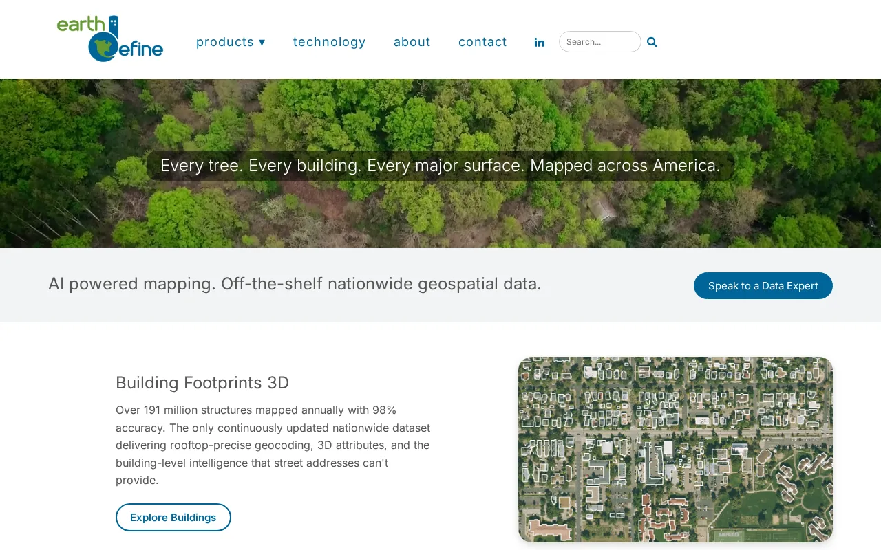
A specialized tool for precise terrain mapping with strong satellite imagery integration.
- High-resolution satellite imagery integration
- Accurate terrain mapping specialized for agriculture and environment
- Analytical tools for detailed geospatial insights
- Limited third-party integrations
- Steeper learning curve for non-experts
Is EarthDefine Right for You?
A quick checklist to help you decide.
Ideal for: Agriculture specialists, environmental scientists, and urban planners needing accurate terrain data from satellite imagery.
Less suited for: Casual users or teams without geospatial expertise who need simple mapping or non-terrain satellite data.
Bottom line: Precision and analytical depth in terrain mapping using satellite imagery.
AI-assessed from 3 sources.
Pros
Cons
Free
Best for individuals
- Basic terrain mapping
- Limited satellite imagery access
Offers a free tier with basic features; paid plans unlock advanced analytics and higher usage limits.
What is this tool?
How much does it cost?
Does it have a free plan?
What integrations does it support?
Who is it best for?
No reviews yet. Be the first to review EarthDefine!
Scores are calculated algorithmically from feature coverage, pricing, user feedback & benchmark data — not influenced by commercial relationships. How we score → · Vendor Data Policy